Keystone
Keystone
This is what I found yesterday at Keystone.
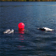
The only thing missing from the picture - DIVERS !
http://JanKocian.smugmug.com
I take photos because I like it, not because I'm good at it. by Unknown
Re: Keystone
Now that's my kinda dive site!
Only question is was the viz that good?
http://dustys-lights.com/, An awesome light at an unbelievably low price
Dusty's Lights on facebook
http://underthesound.smugmug.com/
Dusty's Lights on facebook
http://underthesound.smugmug.com/
Re: Keystone
Man, what was the occasion? If hot pizza is on offer at Keystone, I'd dive there more often!
"Sometimes, when your world is going sideways, the second best thing to everything working out right, is knowing you are loved..." ljjames
Re: Keystone
These were exactly my thoughts when I saw the rig.LCF wrote:Man, what was the occasion? If hot pizza is on offer at Keystone, I'd dive there more often!
When I asked if they serve pizza to old and cold divers ( I just came out of water ),
they told me that Wounded Warriors Soldier Bike ride is scheduled to make a stop here...
So it was for a good cause. And as for divers? BYO
http://JanKocian.smugmug.com
I take photos because I like it, not because I'm good at it. by Unknown
Re: Keystone
Hmmm, :angry:
http://dustys-lights.com/, An awesome light at an unbelievably low price
Dusty's Lights on facebook
http://underthesound.smugmug.com/
Dusty's Lights on facebook
http://underthesound.smugmug.com/
Re: Keystone
Hi Jan. I have never heard or seen anything on Keystone before your thread. Can you post a link for this location that would give some good info? Also, is this a good site for rookies or is it a more advanced site? You know, current sensitive, depth requirements and so on?
Thanks,
Dave
PS: The pic you post is really cool..did you take that?
Thanks,
Dave
PS: The pic you post is really cool..did you take that?
Re: Keystone
Hi Dave, you got to come to Whidbey. Maybe not a pizza waiting for you, but lots of sea life ...LowDrag wrote:Hi Jan. I have never heard or seen anything on Keystone before your thread. Can you post a link for this location that would give some good info? Also, is this a good site for rookies or is it a more advanced site? You know, current sensitive, depth requirements and so on? Thanks, Dave
PS: The pic you post is really cool..did you take that?
Here is the write up from Whidbey Dive Center:
Keystone Underwater Park
Recommended type of dive: Shore
How to dive this site: Two dives are possible here. "The Jetty" and "The Pilings". The Jetty dive is the most common, with thousands of divers from several states visiting it each year. Most local certification courses are held here. To dive The Jetty, you should begin by gearing up in the parking area and hiking down to the east side of the jetty itself. Stay to the left of the rocks and follow them to the end in 55' of water or around to the other side. "Rounding the end" of the jetty as it is called is best done during a flood current. The end of the jetty should not be approached during an ebb tide since the current may pull you away from the rocks.
HAZARD: While this site is recommended for divers of all skill levels, beginners should dive here during a slack period. The current at this site may be strong at times and has the capability of pulling a diver out into the ferry traffic lane.
To dive The Pilings, you must hike your gear down the beach to the east until you are standing in front of the old wharf to the left of the jetty. Gear up and swim out to the pilings where you should make your descent. Although the current can be strong until reaching the pilings, it is minimal once you are inside of them. Maximum depth here is 35' depending on the tide height. An excellent drift dive can be done on the end of a flood movement by leaving the pilings and drifting to the jetty.
Directions to the site: GPS Coordinates: N. 48 09.408 W. 122 40.267 (Boat ramp)
From Oak Harbor - Follow SR20 South to Coupeville. Once there, turn right on Main, which turns into Engle Road, and follow it the to Keystone Ferry terminal. Pass the ferry entrance and turn into the state park.
From Clinton - Follow Highway 525 North until turning left onto Wanamaker Road just after Admirals Cove. Follow Wanamaker Road to the ocean where you will turn right on to Keystone Road. Continue on Keystone towards the ferry landing. Turn left into the State Park just before the terminal.
And more photos from there:
http://jankocian.smugmug.com/Other/Keys ... &k=9VV7RsN
Last edited by Jan K on Sun Sep 22, 2013 9:17 am, edited 1 time in total.
http://JanKocian.smugmug.com
I take photos because I like it, not because I'm good at it. by Unknown
Re: Keystone
Awesome!!!
...I like going to the chamber.. They have great food there, and awsome live music "H20doctor"
Check out the VIDEOS!
Re: Keystone
LowDrag, Keystone is one of the best shore dives in all Puget Sound -- but it is current-sensitive, so it's good to take a look at tides before you come over here to dive it.
"Sometimes, when your world is going sideways, the second best thing to everything working out right, is knowing you are loved..." ljjames
Re: Keystone
Sounds like a bit more experience reading tide charts is in order. I don't have nearly enough practice at tide chart reading yet. Also sounds like a good place to go with someone who has been there before. Thanks LCF and Jan for the info.
Jan, I looked at your pic's. Those are definitely some cool pic's you have of this site. I really liked the ones where you joined the surface pic with the underwater pic. That is a really cool effect.
Re: Keystone
Keystone is a dive where one would consult Current Charts/Tables since the state of water currents are are dependent on the tides but don't directly correlate with the tidal state. The tide tables will give you a rough idea of the magnitude of the currents but without significant local knowledge you won't know when to exact peak and slack currents based solely on tide tables.LowDrag wrote:Sounds like a bit more experience reading tide charts is in order.
NOAA is the source of both current data and predictions that are often republished in a variety of formats by other entities. xTide is a popular open source computer program that many other programs, apps, and web sites with tide and/or current predictions are based on. Generally in any given region actual measurements are taken at a handful of stations and predictions for other locations are interpolated from the direct observations. The predictions don't consider real world conditions like flooding rivers or strong winds that can have significant effects on tidal heights and current strengths.
Northwest Shore Dives by Stephen Fischnaller is out of print but a used copy will have his corrections from known stations for many dive sites. You can compare them to the listings here and elsewhere (Perfect Dive, Shorediving.com, Shop web sites, etc.) and hopefully get a better understanding. Finally you will probably find watching an animation of Puget Sound currents more helpful than anything I just wrote.
"Just to be clear, doing the Diamond Knot requires at the minimum double IPAs to be DIR." - MattleyCrue
"Mmmm....... Oreos!
They didn't look too good when I was spitting in my mask for dive #2!" - cardiver
"Mmmm....... Oreos!
They didn't look too good when I was spitting in my mask for dive #2!" - cardiver
- Joshua Smith
- I've Got Gills
- Posts: 10250
- Joined: Mon Apr 03, 2006 9:32 pm
Re: Keystone
Yeah.renoun wrote:Keystone is a dive where one would consult Current Charts/Tables since the state of water currents are are dependent on the tides but don't directly correlate with the tidal state. The tide tables will give you a rough idea of the magnitude of the currents but without significant local knowledge you won't know when to exact peak and slack currents based solely on tide tables.LowDrag wrote:Sounds like a bit more experience reading tide charts is in order.
NOAA is the source of both current data and predictions that are often republished in a variety of formats by other entities. xTide is a popular open source computer program that many other programs, apps, and web sites with tide and/or current predictions are based on. Generally in any given region actual measurements are taken at a handful of stations and predictions for other locations are interpolated from the direct observations. The predictions don't consider real world conditions like flooding rivers or strong winds that can have significant effects on tidal heights and current strengths.
Northwest Shore Dives by Stephen Fischnaller is out of print but a used copy will have his corrections from known stations for many dive sites. You can compare them to the listings here and elsewhere (Perfect Dive, Shorediving.com, Shop web sites, etc.) and hopefully get a better understanding. Finally you will probably find watching an animation of Puget Sound currents more helpful than anything I just wrote.
Maritime Documentation Society
"To venture into the terrible loneliness, one must have something greater than greed. Love. One needs love for life, for intrigue, for mystery."
Re: Keystone
Keystone has some quirks, because the flood waters are deflected off the headland north of there. They come south a little offshore, and can curl around and create a weaker northbound current inshore. You can dive Keystone on fairly large floods, but even small ebbs can make life difficult. And south winds can make the entry and exit difficult, and mess up the viz.
Very current-sensitive sites like Keystone and Day Island are great places to go with somebody who knows the site reasonably well. They're great fun if planned properly, and can be not fun at all if you mess up (says Lynne, remembering a day where she and her buddy got in the water 45 minutes early at DIW, spent three minutes underwater, and had a 15 minute wade to get back to the exit . . . ).
"Sometimes, when your world is going sideways, the second best thing to everything working out right, is knowing you are loved..." ljjames
Re: Keystone
Good information from everyone. Thank you all. I will definitely look into the current charts/tables as well as the tidal charts.
Thanks everyone,
Dave
Thanks everyone,
Dave
Re: Keystone
Keystones one of my favorite sites, if you need a guide sometime post or shoot a pm and I'll go... Sundays are my primary dive day...
-Alex-
"so in the interest of advising something...let's see..."the early bird may get the worm, but the second mouse gets the cheese!" -Eliseaboo
Re: Keystone
Cool thanks...