Ok, so I sort of tricked you into looking at this thread. But hopefully you won't mind.
It all started last night at around 11:00pm while by the glow of backlit LCD screen I thought "What else is out there?" I wanted to see what I could come up with if I disregarded all knowledge of know dive sites and started from scratch surveying maps, data, and images for locations likely to produce excellent dives.
I fired up Google Earth and turned off labels so as not to be distracted by names. And side-by-side with Lamont's Bathymetry mashup I started cyber-exploring Puget Sound. Using the Bathymetry mashup I would identify sites with steep or irregular depth variations close to shore. Then I would switch to Google Earth to view the topography of the surrounding land features. My hope in viewing in this manner was to distinguish between rocky geographic features and those likely to just be mud plains. This is pretty easy when you tilt the Google Earth image at an angle to see the dry-land geography in 3D.
This was an adictive game, and by 2:00am I had amassed a fair sized list of sites to investigate further. As I expected, subsequent identification of several of the sites I flagged revealed them to be well known and frequented dive sites. My first of the night turned out to be Keystone Jetty. My greatest find of all - the King, the site to end all... turned out to be Deception Pass (I didn't say I was looking for easy sites - just good sites).
Anyway, I did find a couple that I haven't identified as regular known-to-the-general-public sites. Maybe that's because they stink, or maybe it's just that everybody knows about them but me...
Go take a look at this one on Whidbey Island and tell me what you think. The island geography extending inland from this point is very rocky and feature-rich which might mean similar geography beyond the shoreline. Maybe some of you already dive it regularly, or maybe it's a dud. What do you think? Can you get to it without a boat (ie, can you park at the end of Marine Dr. and hike down, or is it private property?)
Grrrr! I can't get this site to take the link. Maybe the URL is too long...
Sorry, you'll have to do it the hard way.
Coordinates are: +48° 13' 39.74", -122° 38' 52.59"
-Ben
The Greatest Undiscovered Dive Sites of the PNW!
The Greatest Undiscovered Dive Sites of the PNW!
Last edited by airsix on Sat Feb 09, 2008 4:16 pm, edited 1 time in total.
 [/b]
[/b]

I give up; what's Lamont's Bathymetry mashup? And the images I get in Google Earth seem to be rather old; for example, only one Narrows bridge. I haven't used it that much so I may be doing something wrong...
Dave
"Clearly, you weren't listening to what I'm about to say."
--
Check out my Internet show:
http://www.irvingszoo.com
"Clearly, you weren't listening to what I'm about to say."
--
Check out my Internet show:
http://www.irvingszoo.com
dwashbur wrote:I give up; what's Lamont's Bathymetry mashup? And the images I get in Google Earth seem to be rather old; for example, only one Narrows bridge. I haven't used it that much so I may be doing something wrong...
Lamont's Awesome Bathymetry Page
Depth Legend:
Red -1
Yellow -66
Green -132
Auqua -198
White -264
Hot Pink -330
...and so on.
Looks a lot like the setup of KVI Tower on Vashon-might be similar in terms of structure. That area is mostly consolidated glacial deposits, so expect a relatively muddy substrate. Could be fun to explore, a group of us have gotten into scouring charts and doing exactly what you are doing. Some dives have better results than others-and we have some interesting spots n the calendar.
Wow. What a site! Thanks!airsix wrote:dwashbur wrote:I give up; what's Lamont's Bathymetry mashup? And the images I get in Google Earth seem to be rather old; for example, only one Narrows bridge. I haven't used it that much so I may be doing something wrong...
Lamont's Awesome Bathymetry Page
Dave
"Clearly, you weren't listening to what I'm about to say."
--
Check out my Internet show:
http://www.irvingszoo.com
"Clearly, you weren't listening to what I'm about to say."
--
Check out my Internet show:
http://www.irvingszoo.com
Thanks Airsix, great info, one of these days I shall check it out. 
http://JanKocian.smugmug.com
I take photos because I like it, not because I'm good at it.") by Unknown
by Unknown
I take photos because I like it, not because I'm good at it.
D8ive Site
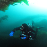
I am going to have to check this out. I have my boat in the Oak Harbor Marina. this is only a few minutes away. I have never had good visibility in Saratoga Passage, but there is some current, but it is mild. The mouth of the Skagit River is only a few miles away, which accounts for the poor visibility.
I will dive it sometime and report back.
Pat Harman
I will dive it sometime and report back.
Pat Harman
Thanks for the positive input, guys.
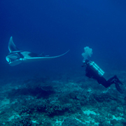
Here's one that looks like it has real potential, but there is no shore access.
This one gives me goosebumps. Good exposure to the sun, rocky & vertical, good exchange... I bet a lot of critters live there.
Site 002
48°25'36.94"N
122°40'28.32"W
This is 3/4 mile Northwest of Rosario Beach. As I post these feel free to let me know if they are "nothing new". I'd like to hear about them regardless.
Last edited by airsix on Sun Feb 10, 2008 10:44 am, edited 1 time in total.
Don't worry Ben, I appreciate your effort to expend our diving opportunities by utilizing your computing talents 
http://JanKocian.smugmug.com
I take photos because I like it, not because I'm good at it. by Unknown
I take photos because I like it, not because I'm good at it.
be sure to take lots of pictures when you explore this site and if you need a dive budy for this let me know I hope to have my dry suit back in a week or two and will be more then ready to go exploring the puget sound
And rember the rule if you find a unknown dive site you get to name it
I am looking fioward to seeing what you decide to call it
I think the cove looking area looks really promising it sure looks well protectedmight make for a nother nice back up site
Sparky
And rember the rule if you find a unknown dive site you get to name it
I am looking fioward to seeing what you decide to call it
I think the cove looking area looks really promising it sure looks well protectedmight make for a nother nice back up site
Sparky
A Smart Man
Learns from his mistakes
A Wise Man
Learns from the mistakes of those that have gone before him
Learns from his mistakes
A Wise Man
Learns from the mistakes of those that have gone before him
ppharman wrote:There is a rock pinnacle in the San Juan’s in Griffin Bay on the East side of San Juan Island. It looks on the chart to be a potential dive site. It is at 48°30.397'N 122°59.474'W
Anybody ever dive this site?
Pat Harman
Wow, Pat. That immediate area is LOADED with interesting features. Excellent find! (The pinacle Pat mentioned is the red blotch in the center of the image below.)
