
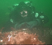
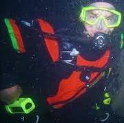
Saturday, GUE Seattle is having our second Project Baseline dive.
What's Project Baseline? This is an idea conceived by GUE Headquarters, involving documentation of dive sites. How many of us have heard someone say, "Oh, you may like Waterman's Wall, but you should have seen it ten years ago . . . "? The problem is that so many people get into diving and out of it, and the life expectancy is somewhere around five years. Each new crop of divers gets into the water and marvels at what they see . . . because what they see IS their baseline, and they have no other.
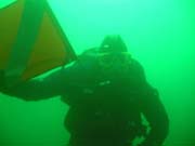
Project Baseline is about documenting dive sites, in whatever way we can. Whether it's physical survey, photo documentation, fish counts, visibility measurements, water quality assays, or whatever we can figure out how to do, we are trying to characterize our local underwater environment in a way that allows assessment of change over time.
The data gathered by PB groups is uploaded to what is currently a Google Earth-linked program, so that the data are available and visible to anyone who is interested in looking at it.
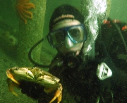
Although this is a GUE-backed initiative, it is open to anyone who wants to contribute. We have divers with excellent buoyancy and propulsion skills, and we have scooters, and familiarity with line and survey techniques. We have some photographers. But we can use help! Whether you want to help record data, or take pictures, or especially if you have training or expertise in critter identification and counting, we can use you, and you can be part of an organized effort to create a meaningful database of information about the underwater world in Puget Sound.
Please contact me if you are interested in participating, whether it's in Saturday's dive at Saltwater, or in the future. You can be part of something solid and positive, and use your diving skills and savvy to give back to the Sound.
Project Baseline
Project Baseline
"Sometimes, when your world is going sideways, the second best thing to everything working out right, is knowing you are loved..." ljjames
Re: Project Baseline
PM sent to you.
...I like going to the chamber.. They have great food there, and awsome live music "H20doctor"
Check out the VIDEOS!
Check out the VIDEOS!
-
seainggreen

- Dive-aholic
- Posts: 246
- Joined: Wed Sep 01, 2010 7:00 pm
Re: Project Baseline
Mike, it would be great to see you there. ") This would be right up your alley methinks.
This would be right up your alley methinks.
Laurynn
Laurynn
mz53480 wrote:PM sent to you.
"Nearly all men can stand adversity, but if you want to test a man's character, give him power." - Abraham Lincoln, 1809 - 1865
Seainggreen Productions, LLC
Seainggreen Productions, LLC
-
archaeofish
- Aquaphile
- Posts: 122
- Joined: Thu Dec 11, 2008 6:03 am
Project Baseline
Please consider uploading your critter sightings to the REEF database as well. Janna coordinated some baseline surveys at Saltwater after the new structures were built and every survey report will help to document the changes at this site. Thank you for all your efforts!
While it's generally acknowledged that wetsuit divers are a shade or two crazier than the rest of us, we're all special idiots for voluntarily diving in dark, cold, water! - scottsax

Re: Project Baseline
+1archaeofish wrote:Please consider uploading your critter sightings to the REEF database as well. Janna coordinated some baseline surveys at Saltwater after the new structures were built and every survey report will help to document the changes at this site. Thank you for all your efforts!
More Pics Than You Have Time To Look AT
"Anyone who thinks this place is over moderated is bat-crazy anarchist." -Ben, Airsix
"Warning: No dive masters are going to be there, Just a bunch of old fat guys taking pictures of fish." -Bassman
"Anyone who thinks this place is over moderated is bat-crazy anarchist." -Ben, Airsix
"Warning: No dive masters are going to be there, Just a bunch of old fat guys taking pictures of fish." -Bassman
Re: Project Baseline
One of the things I am trying to coordinate is getting all of our PB divers REEF certified. There's a significant overlap in goals there.
"Sometimes, when your world is going sideways, the second best thing to everything working out right, is knowing you are loved..." ljjames
Re: Project Baseline
You can do REEF surveys without being 'certified'. I'll post the links here when I'm in front of a computer, but anyone can sign up for REEF and submit a survey online. Should the diver choose they can take classes and tests and progress up 'levels' that they set, but anyone can do a survey and all data is valuable and looked at and used.LCF wrote:One of the things I am trying to coordinate is getting all of our PB divers REEF certified. There's a significant overlap in goals there.
More Pics Than You Have Time To Look AT
"Anyone who thinks this place is over moderated is bat-crazy anarchist." -Ben, Airsix
"Warning: No dive masters are going to be there, Just a bunch of old fat guys taking pictures of fish." -Bassman
"Anyone who thinks this place is over moderated is bat-crazy anarchist." -Ben, Airsix
"Warning: No dive masters are going to be there, Just a bunch of old fat guys taking pictures of fish." -Bassman
-
Cmjstealth
- Avid Diver
- Posts: 79
- Joined: Sat Jan 29, 2011 11:02 pm
Re: Project Baseline
I'd love to know if/how I can help.
Re: Project Baseline
What is the link? I'd be interested in seeing the web site, and the current data.LCF wrote:...The data gathered by PB groups is uploaded to what is currently a Google Earth-linked program, so that the data are available and visible to anyone who is interested in looking at it.
Thanks,
D
-
Cmjstealth
- Avid Diver
- Posts: 79
- Joined: Sat Jan 29, 2011 11:02 pm
Re: Project Baseline
I had an idea a few months ago that I thought would be cool... curious if it is similar at all to what you are working on. Essentially I thought of taking hundreds of photographs looking straight down from 5 or so feet from the ocean floor. After getting 100% coverage of a site the photos can be programaticlly stiched together and Microsoft deep zoom technology can be used to browse it as a single image... or massive photo "map" of every inch of the floor (sort of like how bing or google maps works).
Some examples of the technology. These are all examples of deep zoom across multiple images but I'm thinking of it being used as one massive high rez image of the entire ocean floor:
http://memorabilia.hardrock.com/
http://deepzoompublisher.com/ClientBin/Cities.html
Photosynth is another technology I was thinking of trying but I'm not sure if it could scale to the level I'm thinking. I haven't seen it used for a purely "top down" map style application. Would be neat though as it can take into account 3 dimensions and can allow for varying levels of detail. Here is an example of one I made from the pictures I took in Alaska: http://photosynth.net/view.aspx?cid=266 ... 28cf6551e7
I need to do a proof of concept I think.
Re: Project Baseline
I used an open source Hugin image stitcher for creating panorama's back in the day. It can absolutely be done, however you've got to wait for the best conditions depending on the distance you want to shoot at.
http://deadplanet.net/wp-content/upload ... esktop.jpg
Les Davis Shallow Reef. This was shot in about 10-15 feet of viz, but because of the angles I was taking, it gives an image with much better visibility.
D
http://deadplanet.net/wp-content/upload ... esktop.jpg
Les Davis Shallow Reef. This was shot in about 10-15 feet of viz, but because of the angles I was taking, it gives an image with much better visibility.
D
Cmjstealth wrote:I had an idea a few months ago that I thought would be cool... curious if it is similar at all to what you are working on. Essentially I thought of taking hundreds of photographs looking straight down from 5 or so feet from the ocean floor. After getting 100% coverage of a site the photos can be programaticlly stiched together and Microsoft deep zoom technology can be used to browse it as a single image... or massive photo "map" of every inch of the floor (sort of like how bing or google maps works).
Some examples of the technology. These are all examples of deep zoom across multiple images but I'm thinking of it being used as one massive high rez image of the entire ocean floor:
http://memorabilia.hardrock.com/
http://deepzoompublisher.com/ClientBin/Cities.html
Photosynth is another technology I was thinking of trying but I'm not sure if it could scale to the level I'm thinking. I haven't seen it used for a purely "top down" map style application. Would be neat though as it can take into account 3 dimensions and can allow for varying levels of detail. Here is an example of one I made from the pictures I took in Alaska: http://photosynth.net/view.aspx?cid=266 ... 28cf6551e7
I need to do a proof of concept I think.
Re: Project Baseline
http://www.projectbaseline.orgdefied wrote:What is the link? I'd be interested in seeing the web site, and the current data.LCF wrote:...The data gathered by PB groups is uploaded to what is currently a Google Earth-linked program, so that the data are available and visible to anyone who is interested in looking at it.
Thanks,
D
This is the overall Project Baseline link, the PNW Project Baseline just started and we are in the beginning stages of the project.. Hence needing YOUR help to ensure success in gathering data around our beloved waters.
So, You can expect a ton of data to be shoved into the project from our activities on the PNW Project baseline.
K
"I believe that if life gives you lemons, you should make lemonade... And try to find somebody whose life has given them vodka, and have a party" - Ron White
Re: Project Baseline
Cool, thanks!
D
D
Re: Project Baseline
Tom Nic wrote:You can do REEF surveys without being 'certified'. I'll post the links here when I'm in front of a computer...LCF wrote:One of the things I am trying to coordinate is getting all of our PB divers REEF certified. There's a significant overlap in goals there.
Lynne - I (along with several other regulars on this board) am an active volunteer surveyor with REEF and part of their Advanced Assessment Team in Washington State. Reef essentially works at (among other things) mobilizing "citizen scientists" to do critter surveys while diving. Those surveys are area specific, and are accumulated and made available to researchers around the world who need critter data as part of their research .LCF wrote:Although this is a GUE-backed initiative, it is open to anyone who wants to contribute. ....especially if you have training or expertise in critter identification and counting, we can use you, and you can be part of an organized effort to create a meaningful database of information about the underwater world in Puget Sound.
Anyone can do a REEF survey. Literally, if you were sure you saw a Copper Rockfish on a dive you could go online sign up as a REEf member (it is free) and do a survey reporting one Copper Rockfish as a start. There is already a database in place that is contributed to on almost a daily basis, specific to site, species, relative abundance, time of year, conditions, and knowledge level of the person submitting the survey. REEF offers training opportunities both in person and online to teach divers to identify what they are seeing, and as divers learn they can take tests and advance through various Levels from One through Five. Levels 4 & 5 are "Expert", and all data turned in is organized by these levels - but all the data is kept and used, and all of it is valuable!
I am not sure if I can be there this Saturday yet, but if you would like input / help with the critter watching / ID portion of your surveys I would love to help if I am able / permitted.
I'm not sure what all of the goals of Project Baseline are, but it seems to me that you might want to consider where quality organizations are already doing a piece of what GUE already has in mind, then contributing to that and receiving from their experience and expertise could be a win win and perhaps make organizations of like mind a "Team". Shoot me a PM if this seems like something that might work.
-Tom
More Pics Than You Have Time To Look AT
"Anyone who thinks this place is over moderated is bat-crazy anarchist." -Ben, Airsix
"Warning: No dive masters are going to be there, Just a bunch of old fat guys taking pictures of fish." -Bassman
"Anyone who thinks this place is over moderated is bat-crazy anarchist." -Ben, Airsix
"Warning: No dive masters are going to be there, Just a bunch of old fat guys taking pictures of fish." -Bassman
Re: Project Baseline
Tom, I will shoot you a PM, but synergy with other organizations or people who are collecting data is exactly what I have in mind. When I talk about getting REEF "certified", I realize that you don't have to have any specific training to submit surveys -- but the validity of the data is much better if people have been examined and shown to have some actual ability to correctly identify species, which is what I would like to build for our organization.
defied, that panorama is fantastic -- it would be outrageous if we could use our photographic talents to build some major pictures of the sites. I'm also eager to find someone who works with bathymetry programs to take the survey data I'm hoping we'll get on Saturday, and use the program to build a 3D representation of the site. I've seen this done, most recently with the BAUE project mapping Middle Reef in Point Lobos.
Lots of things we can do . . . but we need the resources! Whether it's taking survey data, counting fish, measuring visibility, or doing the computer work that has to be done to collate and make intelligible the results, there's room for everybody.
"Sometimes, when your world is going sideways, the second best thing to everything working out right, is knowing you are loved..." ljjames

Re: Project Baseline
Gigapan is another fascinating technology... Here's a panorama shot with a Pentax 645 medium-format body (amazing hte level of detail you can zoom in to see) http://www.gigapan.org/gigapans/76785/ You'd be counting the cells in a Octo's color spotsCmjstealth wrote:I had an idea a few months ago that I thought would be cool... curious if it is similar at all to what you are working on. Essentially I thought of taking hundreds of photographs looking straight down from 5 or so feet from the ocean floor. After getting 100% coverage of a site the photos can be programaticlly stiched together and Microsoft deep zoom technology can be used to browse it as a single image... or massive photo "map" of every inch of the floor (sort of like how bing or google maps works).
Some examples of the technology. These are all examples of deep zoom across multiple images but I'm thinking of it being used as one massive high rez image of the entire ocean floor:
http://memorabilia.hardrock.com/
http://deepzoompublisher.com/ClientBin/Cities.html
Photosynth is another technology I was thinking of trying but I'm not sure if it could scale to the level I'm thinking. I haven't seen it used for a purely "top down" map style application. Would be neat though as it can take into account 3 dimensions and can allow for varying levels of detail. Here is an example of one I made from the pictures I took in Alaska: http://photosynth.net/view.aspx?cid=266 ... 28cf6551e7
I need to do a proof of concept I think.
Jim
<Penopolypants> "I, for one, would welcome our new cowboy octopus overlords."
<LCF> "There is ALWAYS another day to dive, as long as you get home today."
<LCF> "There is ALWAYS another day to dive, as long as you get home today."
-
Cmjstealth
- Avid Diver
- Posts: 79
- Joined: Sat Jan 29, 2011 11:02 pm
Re: Project Baseline
Next time I get in the water I'm going to try a non-panoramic image set and see what I can do (ie: pictures of multiple points from multiple points - not a single point like in the gigapan example). Curious if any of these stiching technologies will be able to stich them together nicely into a "flat" 2d image.RoxnDox wrote: Gigapan is another fascinating technology... Here's a panorama shot with a Pentax 645 medium-format body (amazing hte level of detail you can zoom in to see) http://www.gigapan.org/gigapans/76785/ You'd be counting the cells in a Octo's color spots
Jim
My best friend's first pilot job after school was to take areal images used for the "bird's eye view" of what is now bing maps. Essentially had a small airplane with an array of cameras on the bottom (pointing down) that he flew back and forth across the US (sort of like mowing a lawn). I'm curious what an underwater equivilent of this approach would yield.

Re: Project Baseline
This sounds like a huge time consuming project you guys are talking about. But that would be awesome if there was such maps available.
Cmjstealth wrote:Next time I get in the water I'm going to try a non-panoramic image set and see what I can do (ie: pictures of multiple points from multiple points - not a single point like in the gigapan example). Curious if any of these stiching technologies will be able to stich them together nicely into a "flat" 2d image.RoxnDox wrote: Gigapan is another fascinating technology... Here's a panorama shot with a Pentax 645 medium-format body (amazing hte level of detail you can zoom in to see) http://www.gigapan.org/gigapans/76785/ You'd be counting the cells in a Octo's color spots
Jim
My best friend's first pilot job after school was to take areal images used for the "bird's eye view" of what is now bing maps. Essentially had a small airplane with an array of cameras on the bottom (pointing down) that he flew back and forth across the US (sort of like mowing a lawn). I'm curious what an underwater equivilent of this approach would yield.
"Our greatest glory is not in never falling, but in getting up every time we do."
-Confucius
-Confucius
Re: Project Baseline
The raw material for our orthophotoquads! (aka "Orthographically rectified photographic quadrangles") Way back when they were the sort of thing the USGS (and equivalents worldwide) produced, nowadays they're also produced by numerous remote-sensing companies. That was the career field I wanted to get into when I got my USAF commission, but they had other ideas and I ended up in comm/computers...Cmjstealth wrote:Next time I get in the water I'm going to try a non-panoramic image set and see what I can do (ie: pictures of multiple points from multiple points - not a single point like in the gigapan example). Curious if any of these stiching technologies will be able to stich them together nicely into a "flat" 2d image.RoxnDox wrote: Gigapan is another fascinating technology... Here's a panorama shot with a Pentax 645 medium-format body (amazing hte level of detail you can zoom in to see) http://www.gigapan.org/gigapans/76785/ You'd be counting the cells in a Octo's color spots
Jim
My best friend's first pilot job after school was to take areal images used for the "bird's eye view" of what is now bing maps. Essentially had a small airplane with an array of cameras on the bottom (pointing down) that he flew back and forth across the US (sort of like mowing a lawn). I'm curious what an underwater equivilent of this approach would yield.
Jim
<Penopolypants> "I, for one, would welcome our new cowboy octopus overlords."
<LCF> "There is ALWAYS another day to dive, as long as you get home today."
<LCF> "There is ALWAYS another day to dive, as long as you get home today."
Re: Project Baseline
Hey Tom,Tom Nic wrote: I'm not sure what all of the goals of Project Baseline are, but it seems to me that you might want to consider where quality organizations are already doing a piece of what GUE already has in mind, then contributing to that and receiving from their experience and expertise could be a win win and perhaps make organizations of like mind a "Team". Shoot me a PM if this seems like something that might work.
-Tom
Does REEF supply public access to their entire database, or do you have to have a membership to access it?
D
Re: Project Baseline
I believe that it is public, but I'm not 100% sure how that works. Shoot Janna (nwscubamom) a PM and she can give you the particulars or point you in the right direction.defied wrote:Hey Tom,Tom Nic wrote: I'm not sure what all of the goals of Project Baseline are, but it seems to me that you might want to consider where quality organizations are already doing a piece of what GUE already has in mind, then contributing to that and receiving from their experience and expertise could be a win win and perhaps make organizations of like mind a "Team". Shoot me a PM if this seems like something that might work.
-Tom
Does REEF supply public access to their entire database, or do you have to have a membership to access it?
D
Go here and that will give you some idea of a good start.
Oh, and membership is necessary to submit data, but it is free and is as simple as filling out a form .
More Pics Than You Have Time To Look AT
"Anyone who thinks this place is over moderated is bat-crazy anarchist." -Ben, Airsix
"Warning: No dive masters are going to be there, Just a bunch of old fat guys taking pictures of fish." -Bassman
"Anyone who thinks this place is over moderated is bat-crazy anarchist." -Ben, Airsix
"Warning: No dive masters are going to be there, Just a bunch of old fat guys taking pictures of fish." -Bassman